


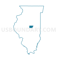
CLINTONIA 1 Voting District, De Witt County, Illinois
About
Outline

Summary
| Unique Area Identifier | 569993 |
| Name | CLINTONIA 1 Voting District |
| County | De Witt County |
| State | Illinois |
| Area (square miles) | 8.36 |
| Land Area (square miles) | 8.36 |
| Water Area (square miles) | 0.00 |
| % of Land Area | 100.00 |
| % of Water Area | 0.00 |
| Latitude of the Internal Point | 40.18464630 |
| Longtitude of the Internal Point | -88.93681840 |
Maps


Graphs
Select a template below for downloading or customizing gragh for CLINTONIA 1 Voting District, De Witt County, Illinois


Neighbors
Neighoring Voting District (by Name) Neighboring Voting District on the Map
- CLINTONIA 2 Voting District, De Witt County, IL
- CLINTONIA 7 Voting District, De Witt County, IL
- CLINTONIA 9 Voting District, De Witt County, IL
- HARP Voting District, De Witt County, IL
- WAPELLA Voting District, De Witt County, IL
Top 10 Neighboring County Subdivision (by Population) Neighboring County Subdivision on the Map
- Clintonia township, De Witt County, IL (7,832)
- Wapella township, De Witt County, IL (944)
- Harp township, De Witt County, IL (311)